How six companies are building the future of geospatial systems—from real-time Earth monitoring to predictive intelligence. The stack that's replacing static maps with decision engines.
Most geospatial systems are built to show you what's happening. A handful of companies are building systems that let you interact with what's happening—in real time, across multiple data layers, with immediate action. This isn't a future vision. It's already being built. But the ecosystem is fragmented, and no single company has unified the full stack yet. That's where the opportunity lies.
Why Static Geospatial Systems Don't Scale
Traditional geospatial stacks work like this: ingest data, process it, display it on a map. You get dashboards, filters, and layers. You can see what happened.
But the moment a user needs to answer a question the system wasn't designed for, everything breaks. You're back to waiting for a data team to run another query. That's not intelligence. That's reporting.
The problem compounds across three dimensions:
Data limitations. Most geospatial systems rely on optical satellite imagery. Clouds, darkness, and weather make half the planet invisible at any given moment. You're building a system that's fundamentally blind 50% of the time. Add in latency (days between captures instead of hours), and you're always working with stale data.
Interaction friction. Once data is on a map, exploring it requires pre-built filters and dashboards. Ask a question the system wasn't designed for, and you're stuck. No cross-layer reasoning, no ad-hoc queries, no "what if" analysis. Users experience this as: submit request → wait for analyst → get answer a week later.
Fragmented tooling. Data comes from one vendor, processing from another, visualization from a third. Nothing talks to everything else. Building an end-to-end system that fuses data, applies intelligence, and enables real-time interaction requires stitching together incompatible tools. That's engineering debt before you've shipped anything.
Real interactive geospatial intelligence flips this. Instead of "here's a map," the system says "ask the map anything." Instead of stale optical data, it fuses real-time multi-modal signals. Instead of pre-built dashboards, it enables spatial reasoning at query time.
The Companies Already Building the Future
A generation of companies is pushing geospatial systems far beyond static visualization. But here's what's interesting: each one is solving a different layer of the problem. Together, they're the blueprint for what comes next.
1. blackshark.ai - Turning Imagery Into Queryable 3D Worlds
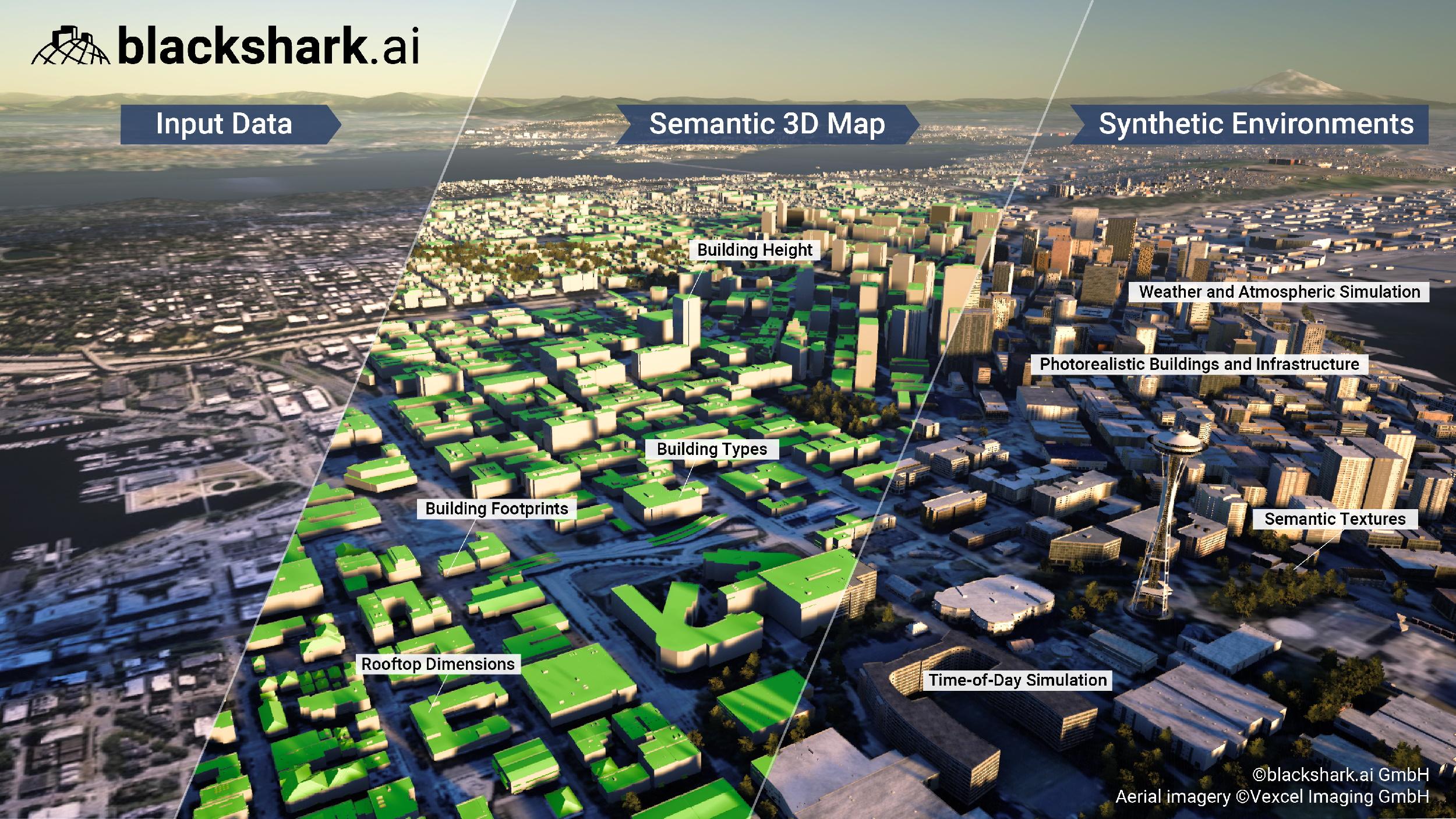
Core capability: Convert raw satellite and aerial imagery into real-time, interactive 3D digital twins of the planet.
Key features:
- Transforms satellite and aerial imagery into fully attributed 3D environments
- Enables object detection and tracking at scale
- Fuses multi-source imagery into a single operational layer
- Powers spatial reasoning directly on a digital world model
Why it matters: This is the foundational layer. Moves from pixels to objects to environments. You're not looking at a picture anymore—you're querying a representation of reality itself. That's what makes interaction possible.
2. ICEYE - Real-Time Earth, Regardless of Conditions
Core capability: Operate a constellation of synthetic aperture radar (SAR) satellites that see through clouds, darkness, and weather.
Key features:
- Can monitor the Earth regardless of weather or time of day
- Provides hourly revisit times, not days
- Detects change at scale without optical imagery constraints
- Enables near real-time continuous monitoring
Why it matters: Most geospatial data depends on optical imagery. That's a fundamental limitation—clouds, night, weather make half the planet invisible. ICEYE breaks that bottleneck. Without this layer, your interactive system is still blind half the time. With it, you can actually monitor continuously.
3. Descartes Labs - From Data to Predictive Intelligence
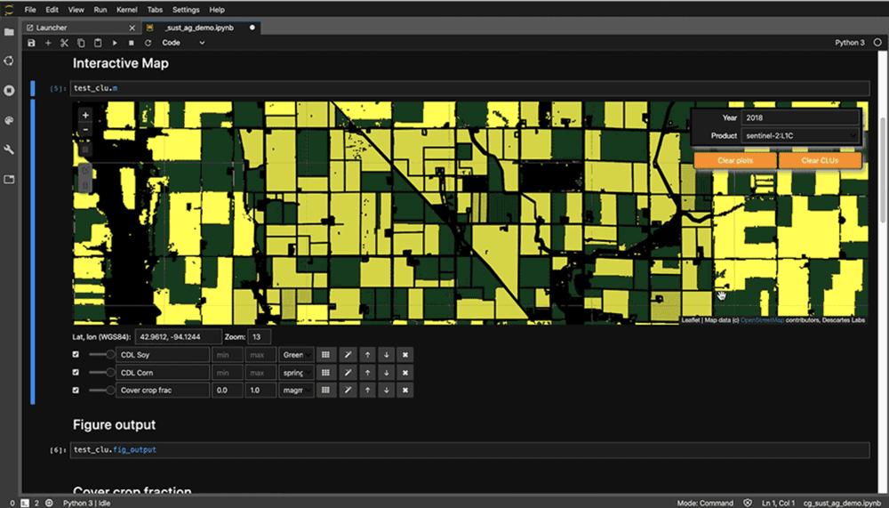
Core capability: Build machine learning models on top of integrated satellite, weather, and environmental data.
Key features:
- Aggregates satellite imagery, weather patterns, and environmental sensors
- Applies machine learning for trend analysis and forecasting
- Supports decision-making in agriculture, energy, and infrastructure
- Moves from "what is happening" to "what will happen"
Why it matters: This shifts the system from reactive observation to predictive intelligence. You're not just asking "what's happening now?" You're asking "what's happening next?" That's when geospatial becomes strategic.
4. Orbital Insight - Extracting Economic Signals From Spatial Data
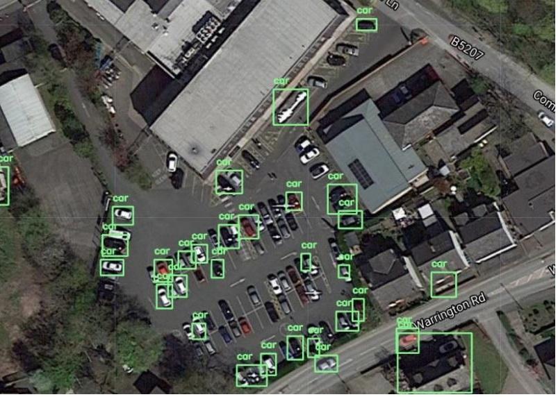
Core capability: Derive real-world economic and behavioral insights by measuring indirect signals at scale.
Key features:
- Combines satellite imagery, mobile geolocation, and machine learning
- Infers retail performance from parking lot activity
- Estimates oil supply levels from tank shadow analysis
- Detects industrial activity through movement patterns
Why it matters: Value isn't in collecting data—it's in interpreting it. This company shows that geospatial can compete with traditional data sources because it measures behavior. Parking lots tell you more about retail health than quarterly earnings might.
5. HawkEye 360 - A New Data Layer: Radio Frequencies
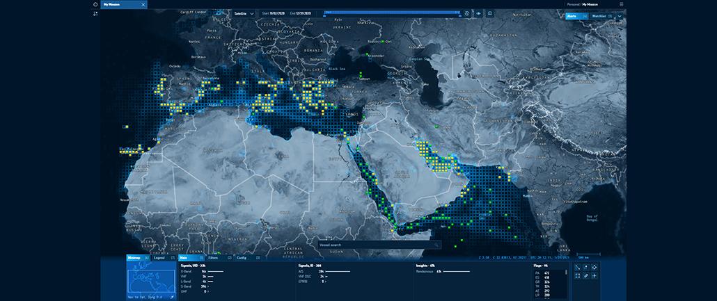
Core capability: Map radio frequency (RF) signals across the planet using a satellite constellation.
Key features:
- Detects ships and vessels even when AIS is turned off
- Tracks communications and radio emitters globally
- Identifies activity invisible to traditional optical imagery
- Enables detection of deceptive behavior and hidden operations
Why it matters: This reminds us that the future isn't better maps—it's more dimensions of reality. You can add an entirely new non-visual layer to your intelligence system. When you combine RF signals with imagery, suddenly you're seeing activity that was completely invisible before.
6. Felt - Making Geospatial Actually Usable
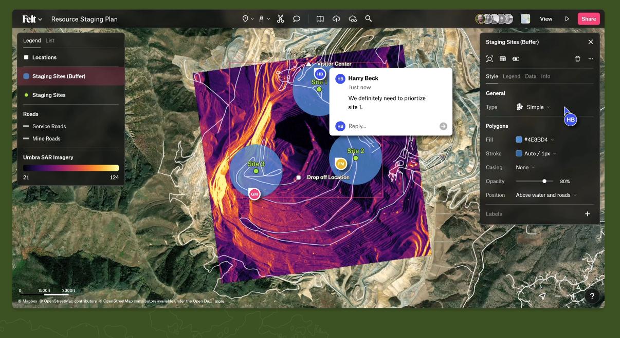
Core capability: Build browser-based, collaborative mapping tools that make geospatial accessible to non-specialists.
Key features:
- Collaborative mapping platform (works like Figma for maps)
- Simple layer composition and real-time sharing
- Lowers the barrier to spatial data exploration
- Makes geospatial tools accessible to non-GIS users
Why it matters: Even the best backend fails if no one can use it. This is the interaction layer—the place where practitioners actually explore and discover. Without this, geospatial stays a specialist domain.
The Architecture: Layer by Layer
What emerges when you map these companies to the technical stack:
| Layer | Company |
|---|---|
| Data acquisition (all conditions) | ICEYE |
| New data modalities (RF signals) | HawkEye 360 |
| World modeling and digital twins | blackshark.ai |
| Analytics and prediction | Descartes Labs |
| Derived intelligence | Orbital Insight |
| User interaction and exploration | Felt |
Individually, these companies are powerful. Together, they start to look like the full stack for interactive geospatial intelligence.
The Gap (And the Real Opportunity)
No company here owns the full loop: Sense → Understand → Query → Decide → Act
Instead, the ecosystem is split:
- Data providers that don't provide intelligence
- Analytics platforms that aren't interactive
- UI tools that aren't connected to advanced analytics
- Decision systems that aren't spatial
What's missing is the unified platform where all data layers are fused, queries are real-time, AI assists exploration, and decisions trigger actions immediately.
At McKenzie Intelligence Services, we worked across this stack—acquiring data from multiple sources, building predictive models, exposing it through interactive interfaces. The biggest discovery was that value isn't in any single layer. It's in how tightly you can connect them.
When you fuse ICEYE's all-weather data with blackshark.ai's 3D world modeling, add Descartes Labs' predictive layer, and expose it through Felt's collaborative interface—suddenly you have something no single vendor provides. That's where the market is heading.
Why This Matters Now
Five years ago, building this end-to-end would have required a team of 50 engineers across multiple specialties. Today, the math has changed:
- Modern data infrastructure handles scale without custom engineering
- Columnar storage and distributed compute are commodities
- AI-assisted development lets small teams do what required large ones
- User expectations have shifted—people expect systems to be interactive
That changes everything. What used to require enterprise budgets can now be built by focused teams with modern tools.
The Future Isn't Maps—It's Decision Engines
The transition happening across these companies points to something bigger. We're moving from:
Systems of record (show me what is)
→ Systems of insight (show me what it means)
→ Systems of action (let me decide and act on it)
Geospatial is one of the most complex domains to execute this in. But that also makes it one of the most valuable. If you can build an interactive system where users ask better questions, get answers instantly, and act with confidence—you're no longer building a map.
You're building intelligence.
Resources and Further Reading
- blackshark.ai — Digital twin and 3D world modeling
- ICEYE — SAR satellite constellation and monitoring
- Descartes Labs — Geospatial analytics and prediction
- Orbital Insight — Economic signals from spatial data
- HawkEye 360 — RF signal mapping and detection
- Felt — Collaborative browser-based mapping
What layer of interactive geospatial intelligence are you most excited about—real-time data, predictive modeling, or usable interfaces? 👇
Andrei Nita
Chief Technology Officer
Building interactive intelligence systems at scale